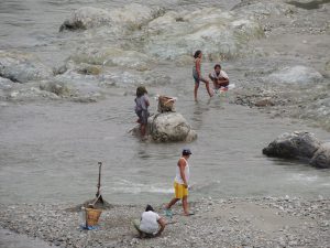
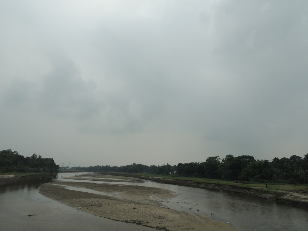
![<p>Where is the water? The Teesta is barely a trickle once it clears the hydropower dams [image by: Jayanta Basu]</p>](https://dialogue.earth/content/uploads/2017/06/DSCN6463-1-768x576.jpg)

The debate over sharing the waters of the Teesta river has become critical to the relationship between Bangladesh and India.
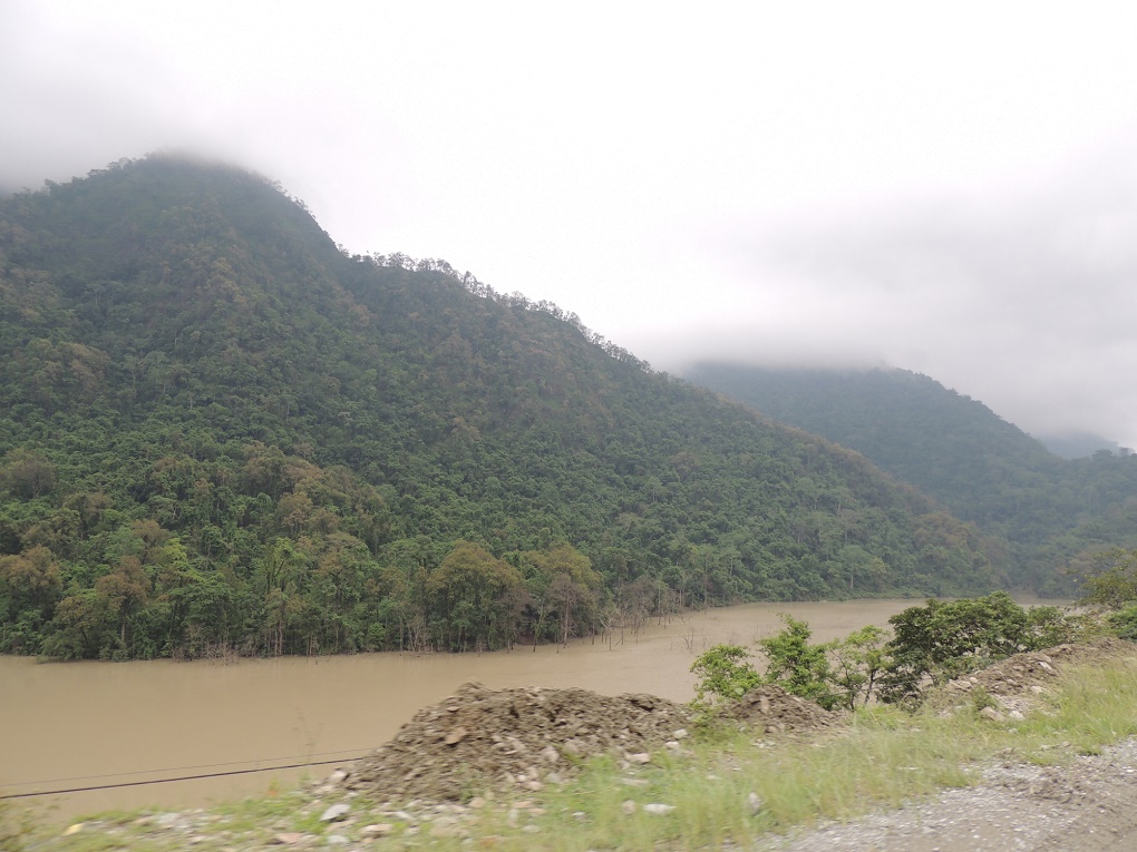
Rising in the eastern Himalayas, the Teesta flows through two Indian states – Sikkim and West Bengal – before reaching Bangladesh and merging with the Brahmaputra.
But to what extent does it flow, except during the four monsoon months, June to September?
This question has become critical as the governments of India and Bangladesh want to sign a Teesta water sharing treaty, but the state of West Bengal objects, saying there is not enough water to share. Given India’s federal system and the current political situation, it has been impossible for New Delhi to ignore Kolkata – a situation likely to continue.
Bangladesh and India share 54 transboundary rivers. As the Teesta treaty foundered once again during Bangladesh Prime Minister Sheikh Hasina’s visit to New Delhi this April, West Bengal Chief Minister Mamata Banerjee offered to share water from other rivers instead. The Bangladesh government did not agree.
See Bangladeshis won’t accept anything short of Teesta treaty
That compounds the problem.
What is the main reason for the opposition by the West Bengal government? As reported first by thethirdpole.net, an internal report of the state government says that in the lean season, the Teesta has about one-sixteenth of the water required to support dry season paddy cultivation – the main livelihood of the majority of people living in this part of West Bengal.
See Teesta has one-sixteenth of water needed
Following that report in thethirdpole.net, there were reports in the Bangladesh media to the effect that the West Bengal government was moving most of the Teesta water away from the river at the Gajaldoba barrage, and moving it to the Mahananda river through a link canal. The Mahananda flows through West Bengal and Bihar before merging with the Ganga a little upstream of the Farakka barrage.
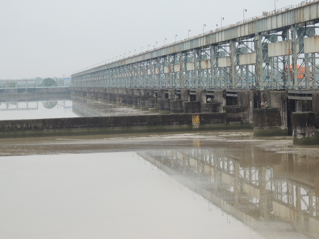
To see what was going on, a reporter on assignment to thethirdpole.net travelled up and down the banks of the Teesta between Sikkim and Gajaldoba – the barrage is just upstream of Jalpaiguri – and spoke to experts.
The travel in early June – before the scenario changes dramatically due to the monsoon rainfall – reconfirmed that just a little bit of water was flowing sluggishly in a few braided channels in the wide Teesta riverbed.
So where is the water?
But there was a large amount of water, just upstream of the many hydropower projects that now dot the Teesta in Sikkim and West Bengal. That provides one of the answers to the question.
Travelling upstream along the Teesta, the Teesta Low Dam Project (Phase IV) comes into view almost as soon as one enters the foothills of the Himalayas. This is supposed to be a 160 megawatt (MW) run-of-the-river hydropower project.
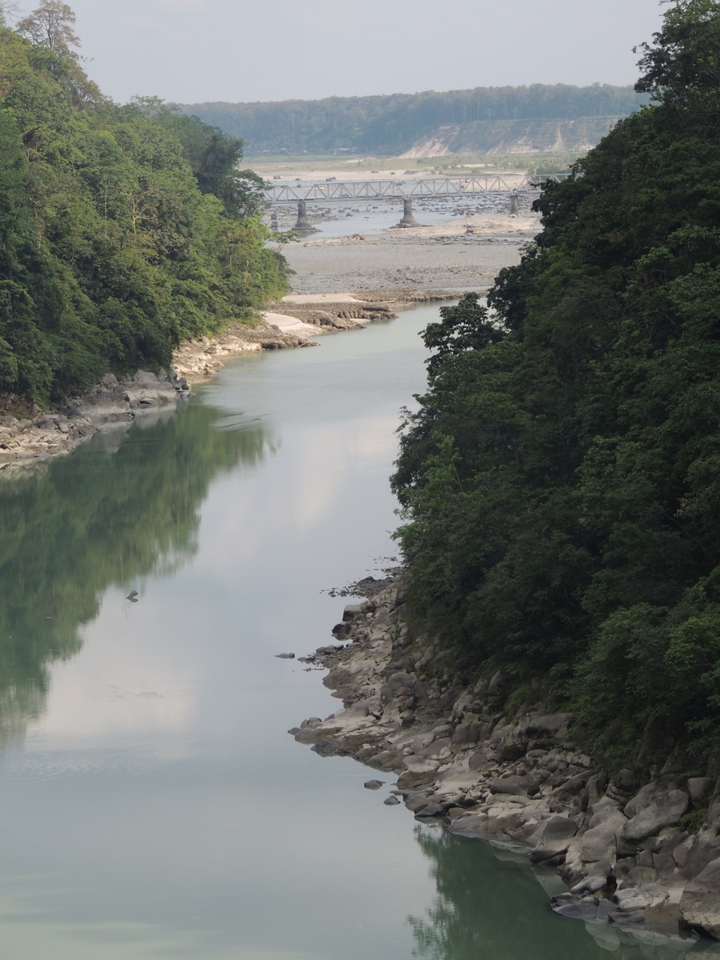
Just downstream of the dam, the riverbed is bone dry. Just upstream is a large pool of stagnant water.
As one travels just a few kilometres further upstream, the scenario repeats itself at the Teesta Low Dam Project (Phase III), a 132 MW run-of-the-river hydropower project.
And it is the same further upstream in Sikkim, where a series of run-of-the-river hydropower plants are running, while more are being built. The larger the plant, the bigger its dam, and the bigger the stagnant pool upstream of the dam.
Run-of-the-river hydropower projects were approved because they would not hold back water. But that is exactly what they are doing. Why?
The reason is an oversupply in India’s national electricity grid. This may come as a surprise to millions of Indians suffering power cuts, but those cuts are due to poor distribution networks, not due to lack of generation. A look at the online national power exchange will show that supply is higher than demand for 20 to 21 hours a day, except during the peak demand period, from 6 pm to 9 or 10 pm.
The result is that all electricity generation companies want to sell power in the evening, the only time when they get peak power rates at the exchange. So, hydropower project managements hold back water for 20-21 hours, and release it during the 3-4 hours when they need the water rushing through their tunnels to turn their turbines.
This has a cascading effect when these projects are in series, as in the Teesta. Since dams upstream are holding the water back, hydropower projects downstream are not getting the water they need through the day. They get it during those 3-4 hours when the water is released by the project management upstream. They store that, to generate power during the next morning’s mini-peak hours and next evening’s peak hours. All of this adds up to a disastrous shortage downstream.
“During these lean months, we can hardly generate hydropower for around three hours a day, equally split in morning and evening. We need to impound the water for that as the water in the Teesta gets highly reduced during the period,” a senior official of Teesta Low Dam Project (Phase III) told thethirdpole.net. “During impounding, generally 1 to 2% of the water is released downstream to maintain the river ecosystem.”
This was confirmed by a senior expert of the Madhya Bharati Power Corporation (MBPC), a private company which is to start generating 96 MW on a tributary of Teesta within a few months. “During the lean season, all, particularly the larger plants, have to impound the water for power generation,” he said. “As per the norms of the Union Ministry of Environment, Forests and Climate Change, all power plants release scanty water during impounding.”
Is there any check on that? Speaking on condition of anonymity, the MBPC expert said, “The Sikkim government is just interested to receive about 15 to 20% proceeds from the plants and hardly monitors [them]. People from the central ministry occasionally come but that is mostly routine in nature.”
Sikkim government officials say 29 hydropower projects are planned in the state, ranging from 30 to 1,200 MW each, totalling close to 4,400 MW. “We need hydropower but not this much … undertaking so many hydropower projects in Sikkim without any proper overall scientific study is going to impact Teesta’s ecology and ecosystem. It’s a scam,” Sonam Wangdi, former chief secretary of Sikkim, told thethirdpole.net.
At a water flow measuring point close to Teesta Bazar, thethirdpole.net found that the Rangit – one of the major tributaries of the Teesta – has barely lost any flow in the last few years, in sharp contrast to the main stem of the Teesta itself. The Rangit has one hydropower project upstream; the Teesta has many.
The nature of the projects
There is a debate on whether these projects can be described as run-of-the-river projects in the first place, though that was the basis on which they were given approvals despite protracted opposition from environmentalists and many residents of Sikkim.
“The NHPC (National Hydro Power Corporation) has declared that Stage III and IV are ‘low and run of the river dams’. However as both are more than 15 metres in height, they cannot be categorised as ‘low’ since the International Commission on Large Dams criteria for a large dam is anything above 15 metres in height,” river expert Kalyan Rudra had written in an earlier academic paper. Rudra also recently told thethirdpole.net that the entire flow of the Teesta had “lost synchronization due to the various ‘stop and store’ steps applied.”
“These are anything but run of the river projects as they are holding water for considerable periods, often in excess of 10 hours at a stretch,” said ecological economist Nilanjan Ghosh of the think tank Observer Research Foundation. “There seems to be little coordination among the plants and as a result there is hardly any coordinated release, and hence flow.”
As the river water is kept impounded for hours at various points, the possibility of evaporation increases. “The evaporation and seepage losses of water in other major irrigation projects in West Bengal is very high. There is no reason to believe that the experience of the TBP (Teesta Barrage Project) would be otherwise,” said Rudra. “We have found that in the Ganga, the evaporation may lead to about 15% water loss. It is highly likely with the water being impounded in stagnant pools, the actual evaporation in the Teesta is higher.”
Ghosh points out that lack of any effective sediment control system – the debris that the river carries from the upstream and gets settled on river bed as the river slows down – in hydropower plants compounds the problem.
Importance of timing in measuring water flow
Given the way the hydropower projects release water into the Teesta in one or two bursts during the day, the timing of the water flow measurement becomes important.
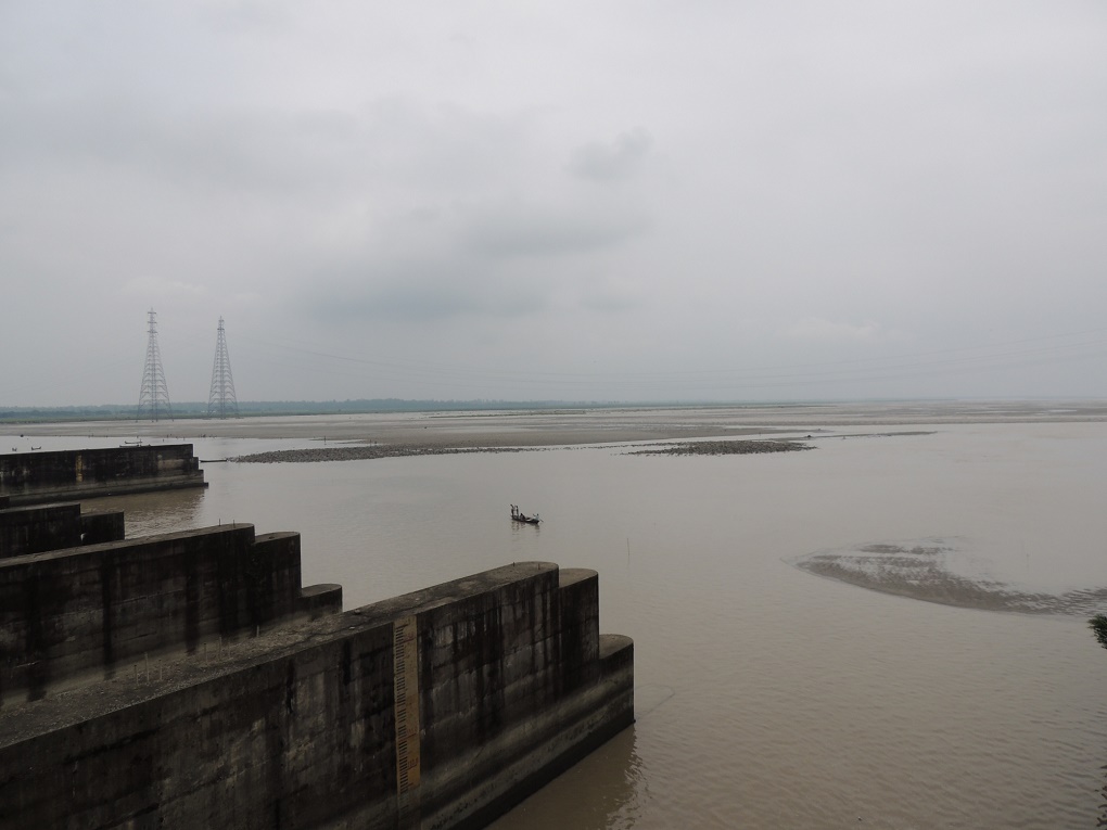
In West Bengal, the flow of the Teesta is measured at three places. Of these, the measurement at Domohani by Central Water Commission (CWC) is the most detailed. Here the water flow is measured from 9 am to 11 am. Some experts point out that due to the maximum release of water in the early evening by hydropower projects upstream, this may not be the best time to measure water flow. Experts at the CWC however point out that the Domohani measuring station is downstream of the Gajaldoba barrage, so any effect of water being released in bursts is evened out by the time the Teesta reaches the measuring point.
The extent to which this effect is being evened out depends on how much of the water is being allowed to flow unimpeded through the Gajaldoba barrage. “It’s a fact that when CWC measures water at Domohani, the peak flow can be absent as hydropower plants generally release water at night,” river expert Kalyan Rudra said.
“I am told that even Bangladesh measures the water in their part (of the Teesta) when the peak flow is already gone,” added another expert.
Not the only reason
But hydropower projects are not the only reason why the Teesta is almost bone-dry during the non-monsoon months, especially in the summer. thethirdpole.net found other major reasons. See the detailed report about that tomorrow.