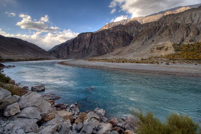
Floods, GLOFs (glacial lake outburst flood), rock sliding, avalanches, land slips, earthquakes… that’s the list of natural disasters threatening Ghizer district in Pakistan’s Himalayan region of Gilgit-Baltistan as the effects of climate change slowly take root.
All three geographic zones of the district, located in the western edge of Gilgit-Baltistan, are prone to hydro-meteorological hazards during spring, summer and winter, says a report jointly prepared by the Aga Khan Rural Support Program (AKRSP), National Disaster Management Authority (NDMA) and the Food and Agriculture Organization (FAO).
The report, the first such on the district comprising the Phander, Yasin, Gupis, and Ishkomen valleys, was prepared after meticulous field exercises and the collection of secondary data.
“Floods happen every year or every second year and are the main causes of socio-economic disruption in the area. Important sources for these floods are glaciers and lakes situated at the higher altitude alpine zones. These sources cause flooding as a result of heavy rains, thunder storms and snow melt,” the report states.
An entire way of life is threatened with the area vulnerable to climate induced natural disasters. Summer temperatures have continued to rise too. “The summer temperature would never go beyond 24 degrees Celsius but it now reaches 30 to 35 degrees Celsius,” said Musa Khan, an official of the Pakistan Meteorological Department in Gupis valley.
About 180,000 people and 19,900 households are at risk, according to 2011 data. While wheat, maize, potatoes and other vegetables are amongst the crops grown for household consumption, small fruit orchards and agro-forestry meet the daily requirements of firewood, fodder and timber. The area also produces fruits such as grapes, walnuts, apples, almonds and apricots and the main forest species include poplar, willow and ailanthus.
According to the report, livelihood assets are now increasingly at risk. The steep topography of the area and the snow and glacier melts in the high mountains and frequent precipitation have exacerbated the threats. Many villages in the upper (single cropping) zones remain isolated for two to three months each year due to landslides, floods, avalanches or some other occurrence.
The hazard intensity, measured against physical, economic and financial losses, in the study was measured on a scale from 1-5. The 2010 flash floods hit a high of five.
A hazard timeline prepared in the report shows that 30 major processes, which include flash/river floods, debris/mud flow, land/rock sliding and GLOF, have been recorded over the last 100 years or so. This scenario draws a picture of frequent natural hazards that influence almost all communities in the region of Pakistan in the district.
The district is also prone to medium to low intensity earthquakes which occur throughout the Karakoram mountain region at frequent intervals. Three union councils — Qurqulti, Bathrath and Gupis — are at high risk from this hazard, says the study.
“There are number of ways in which communities can be ‘helped to help themselves’ reduce the impact of frequently occurring hazards” the study says.
Prioritising long term vulnerabilities, it lists extreme poverty, urban and forest fires, road accidents, poor quality of houses and public infrastructure, poor quality of communication networks (roads, bridges, transmission lines, cellular and land links), disease outbreak, water and sanitation, solid waste management and deforestation.
On the issue of floods, the study cites the 1905 flash floods as a landmark disaster with a hazard intensity of five. Though only one person was killed, there was widespread damage with three villages badly affected. Since then, 30 major floods, debris flow, landslides and rock fall and GLOF have triggered mass level destruction to livelihood assets. Three artificial lakes (Koramber, Gupis and Khalti) were formed as a result of glacier lake outburst, in 1905, 1922 and 1980, respectively.
In 1977-78, a flood destroyed 75% of Darkut village. Since then, regular floods have caused huge losses, destroying agriculture crops, livestock and other assets as well as infrastructure such as schools and homes.
The trauma has lived on. Safraz Shah, a former member of the Gilgit-Baltistan legislative assembly, remembers how a mud-flood submerged three major villages of Khalti in 1980 and formed a huge artificial lake, which still exists and has become a tourist attraction. The flood was caused because of the underground glacier lakes ‘outburst’ due to rapidly melting glaciers.
“The incident affected over 50 households and submerged their houses and irrigated lands, orchards and infrastructure,” said Shah. Fortunately, only one person was killed because it was day time and people were evacuated safely.
More than three decades later, as the Ghizer Valley not too far away battles its worst flood in decades, he says there are still many underground glaciers lakes in various nallahs that could burst any time and cause untold devastation.
“The people in the district should not only be aware about the mitigation measures of the natural calamities, but should also be trained in how to change their livelihoods,” he said, recommending tourism and mining as better livelihood options.
One recent example of such a calamity is the flash flood in the Sundi village of Yasin Tehsil in July 2011. A major portion of the village was washed away including irrigation lands, houses, orchards and linking bridge after bursting out of a glacier lake in the Ququlti Nallah.
Karim Khan was one of those badly hit. His land, including orchards with 300 fruit trees and houses which his family had built over the years, was devastated. “My land is now like a desert with heavy rocks everywhere… “After looking this devastation one cannot imagine that there were orchards of fruit at this place some three years back,” he said.