![<p>Over 60% of the Manas national park has been flooded [image by Sougata Sinha Roy / Wikipedia]</p>](https://dialogue.earth/content/uploads/2016/10/Manas_National_Park-768x576.jpg)

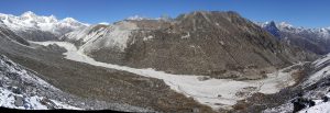
The Manas national park situated in the foothills of the Himalayas in the Indian state of Assam is reeling from a flood since October 12. The park is spread over 2,837 square kilometres (sq km), with 500 sq km as its core area, and up to 60% of its wider area has been reportedly submerged since the floodwaters breached the embankment at Panchmile under the Bansbari Range on Wednesday night.
Assam government officials are blaming the authorities in upstream Bhutan for releasing a huge volume of water from the Kurichhu hydroelectricity project. But Bhutanese officials point out that the Kurichhu project does not have a reservoir, so there is no water stored that they can release. They blame heavy rainfall, and point out that India’s Central Water Commission had as much information as they did, since the Kurichhu project is monitored jointly by Bhutan and India.
“The waters have receded now but have left a trail of devastation,” said Dharanidhar Boro, the deputy director of the park. “The flood breached the embankment at three sites… and damaged most of the roads making movement almost impossible. The bridge at Latajhar was washed away cutting off road communication to Bhutan. Mathanguri, the main attraction for tourists, remains cut off as the road to Mathanguri was also washed away. Animals were seen stranded on narrow strips of highlands, although there were no reports of animal casualties.”
The park was opened for tourists at the beginning of October but authorities are now contemplating limiting access. During the 1990s the Manas national park had fallen off the tourist map as insurgent activities had created security threats. Its recovery has now suffered another jolt, and tour operators fear another season will be lost as reconstruction and repair of roads will take time.
Agriculture and fisheries affected
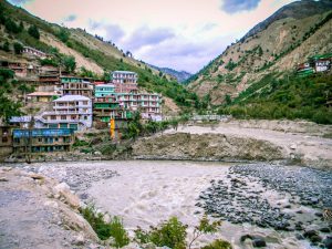
Dhruva Nath, a local youth, lamented that the sudden surge had washed away the dreams of many like him who were engaged in raising fish. Fish farms in the villages of Gyatigaon, Raghabeel, Chunbari, Kaalpani and Narayanguri had their tanks and ponds flooded over and washed away as the gushing waters of the Beki and Manas rivers rolled over them. The Beki and Manas are the two principal tributaries of the Brahmaputra in lower Assam.
A state disaster management authority official said that 12 villages in Kalgachia revenue circle in Barpeta district were inundated by the sudden rise in water level in the Beki river.
Bhutan blamed
Local authorities in the Barpeta and Baksa districts said there was no prior warning by Bhutan about the release of water, which inundated large parts of the districts affecting more than 24,000 people. They are blaming the floods on the release of waters from the Kurichhu hydroelectric project located upstream in Bhutan.
See: Flash floods are burying the lands on the India-Bhutan border in silt
Although there is an agreement between India and Bhutan to share information on the release of water from the Kurichhu project, Assamese authorities allege that Bhutan continues to release water from the dam without sharing the information with them. In July this year, there was a sudden rise in the water levels of the Beki river that washed away a part of the embankment at Panchmile, inundating the entire Manas national park. In June 2010, hundreds of villages in the two districts of Barpeta and Baksa were severely affected. In 2007 there were huge losses in the districts.
In 2004 the Barpeta and Nalbari districts were flooded. It was reported later that an artificial lake on the upstream of Kurichhu project had burst, sending a torrent of water downstream. In the last 10 years, over 100,000 families were rendered homeless, and more than 600 sq km of farmland were devastated in the downstream districts of Baksa, Barpeta and Nalbari as estimated by the Assam Disaster Management Authority.
Bhutanese perspective
The Manas river – known as Drangme Chhu in Bhutan and Niamjang in China – is the largest river system of Bhutan, with a drainage area of 18,300 sq km in eastern Bhutan. A very large share of Bhutan’s revenue comes from hydropower projects, although it has been declining over the years, from 44.6% in 2001 to 20% in 2013. Most of these hydropower projects have been developed in cooperation with India. Bhutan currently has an installed hydropower capacity of 1,488 MW, although it hopes to increase this to 20,000 MW.
See: Dam building spoils Bhutan’s green image
See: Erratic weather spells tough time ahead for Bhutan’s hydropower
Downstream riparian areas, such as India’s Assam state, are increasingly worried that these plans will lead to increased flooding as seen now. The Bhutanese, though, contend that much of the fears are misplaced, and come from lack of information and sensationalist reporting.
Speaking to thethirdpole.net a senior official of the Druk Green Power Corporation, which operates the hydropower plant said, “Much of this reporting is just plain wrong. There is no big dam. The Kurichhu is a run of the river project, and while we do divert the river for about 20-30 metres, we do not have a reservoir. There is no question of releasing water, much less warning India about such release.”
“Furthermore,” he added, “the Kurichhu is a 60 MW project, very small, even the amount we divert is not that large.”
“I wish reporters would visit us, before writing the things they do. We would be happy to show them the project, and explain what we can or cannot do. This is not the Tehri project, or the Bhakra dam [which has a 166 sq km reservoir],” he added.
Bhutan has been experiencing very heavy rainfall over the last few days, leading to landslides, roadblocks and other damage. “The reality,” he said, “is that both Bhutan and India are suffering. We do not have the infrastructure to control this water, what is coming down is flowing through.”
He said that since the project was designed in consultation with, and monitored by India’s Central Water Commission, they had as much information as the Bhutanese authorities. When asked about information sharing, he said that Bhutan shared all of the information about these projects with the Indian Embassy in Thimphu, but he did not know if such information was shared with the Assam state government.
With inputs from Mubina Akhtar in Guwahati