It is now highly likely that a global El Niño weather system is going to develop this year bringing higher temperatures and increased risks of floods, droughts and consequent impacts on crop yields.
The US National Oceanic and Atmospheric Administration’s Climate Prediction Center (NOAA) says there is a 70% chance of an El Niño developing over the next month or two, while the World Meteorological Organization in its most recent update says less categorically that all the necessary conditions are developing in the Pacific.
An El Niño (which in Spanish means ‘the boy’) is caused by a steep rise in water temperatures along the equator in the eastern and central Pacific. This leads to warming of the air which changes wind circulation and causes a sharp change in rainfall patterns.
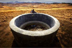
The effects vary in intensity and by region, with some parts of the world – notably southeast Asia, India, central and southern Africa and Latin America – getting drier, while others such as southern Europe, east Africa and the US Midwest get wetter.
“Normally when it is an El Niño year we are worried about some developing countries, especially in southern Africa and east and west Africa. But this year we are more concerned about east and west Africa right now than the south because the rains for this year's harvest have already happened there,” Shukri Ahmed from the United Nations’ Food and Agricultural Organisation (FAO) told chinadialogue.
“If El Niño fully materialises, we are afraid that southern Africa may face a lack of rains from October or November onwards. That is when it gets its main rains. So our main concern is for the harvest that would be coming in next May,” he added.
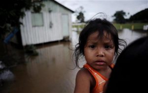
The FAO is also concerned about eastern Africa, where there is a serious risk of flooding if a strong El Niño develops in the next few months, and also about drought in the Sahel – the semi-arid transition zone between the Sahara in the north and the Sudanian savannah in the south – where the NGO Action Against Hunger is warning that 15 million people already face food insecurity.
What is unclear is how strong and therefore how dangerous the probable El Niño is likely to be. An El Niño tends to occur every two to seven years – the last one was in 2007/8 but it was very moderate. The worst on record was in 1997/8, and caused major floods along the Yangtze River in China.
Temperature shifts in March sparked comparisons with the early development of the 1997/8 El Niño, but NOAA said in its latest update that at present a more moderate one looks more likely. It stressed that it was not ruling out an intense one emerging, however.
A major El Niño has historically tended to occur every couple of decades, suggesting that this year’s event could fit into that pattern. But so far this year its development has been slow.
“To be honest, we just don’t know what its intensity will be,” the Met Office spokeswoman said.
“So far, the predictions of a moderate El Niño as well as the actual rains are generally encouraging, in some cases even a bit earlier and a bit stronger than usual, especially in western Africa,” said the FAO’s Ahmed.
“Our main concentration in June up to September is on this part of the world as well as Indonesia, Philippines and others which have more or less continuous rice production. So far we have not yet detected a big trend of drought,” he added.
When an El Niño develops during the northern hemisphere summer, between July and September, it tends to get progressively stronger through the rest of the year and into the early part of the following one before starting to fade. The FAO and climate agencies are watching for that pattern to emerge. “In July our quarterly outlook for crop prospects will raise the issue and give scenarios – floods in the secondary season of eastern Africa and drought in southern Africa. We will also be looking at what may happen in Asia and Latin America,” said Ahmed.
As yet, there is no consensus on how climate change affects or interacts with the El Niño weather phenomenon – whether it exacerbates or nullifies it.
The combined average temperature over global land and ocean surfaces in April this year tied with April 2010 as the highest on record for the month,at 0.77 degrees Celsius above the 20th century average of 13.7 degrees Celsius, according to NOAA.
There are some suggestions that climate change will increase the frequency of El Niños, perhaps even halving the interval between extreme ones. Others say it may not affect the intervals, but might increase the intensity. As would be expected, there are also theories that it might do both.
“There is a big debate on how El Niño and climate change interact,” said Ahmed. “As yet we have no preliminary view directly connecting climate change with the frequency or intensity of El Niños, but no one discounts the possibility,” Ahmed said.


