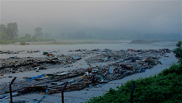
![<p>The Mochu River flooded heavily after the Lemthang glacial lake burst in 2015 [image: Kuensel]</p>](https://dialogue.earth/content/uploads/2017/07/Bhutan2-768x484.jpg)

On the evening of June 26, there were two flash floods in eastern Bhutan. Roads, culverts, bridges, paddy fields were damaged.
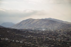
It hardly made news, even in this small country. That is what is perhaps most alarming. Flash floods have become so common during the monsoon in recent years that they hardly make news in this mountainous country in the eastern Himalayas.
In July 2016, Bhutan lost one of the oldest commercial settlements in its southern plains. A long downpour and consequent flooding of the local river wiped out the entire Sarpang town in a matter of hours.
Bhutan flood increase
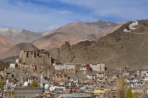
Bhutan is in a high rainfall zone and there is nothing new about its vulnerability to such disasters. The monsoon has always brought 70% of the country’s annual rainfall between June and September.
What is new is the increasing frequency of such flooding, caused by more and more cloudbursts, perfectly in keeping with the forecast of the Intergovernmental Panel on Climate Change (IPCC) that there will now be fewer rainy days but more intense rainfall on those days.
Add to this the glacial lake outburst floods (GLOF), such as the one that occurred at the Lemthang glacier, and the country’s vulnerability has reached a dangerous and chronic level.
Bhutan saw a number of significant water-induced disasters in the last 25 years. Six major events stand out: the 1994 Lugye GLOF, the 2000 monsoon floods in Phuentsholing, the 2004 eastern Bhutan monsoon floods, the 2009 floods induced by Cyclone Aila, the 2015 Lemthang Lake outburst flood, and the 2016 southern Bhutan monsoon floods.
The National Environment Commission’s Bhutan State of Environment Report 2016 warns of increasing rainfall in the southern parts of the country. It also warns about the increased risk of GLOFs. Glaciers are receding at the rate of 30-40 metres per year for those covered with debris and 8-10 metres per year for glaciers free of debris, according to the report.
Statistics from the Kathmandu-based International Centre for Integrated Mountain Development (ICIMOD) show that between 1980 and 2010, glacial lakes in Bhutan increased by 8.7%, while the glaciers shrank by 22%. The Asian Development Bank says that of the 2,794 glacial lakes in the country, 22 are potentially dangerous in terms of GLOF risk.
“Bhutan will see more water-induced disasters in the future,” says Karma Dupchu, Chief of Hydrology and Water Resource Services Division at the National Centre for Hydrology and Meteorology. “Flash floods are our biggest threat.”
Experts say global warming is partly to blame for such heavy rainfall, including cloudbursts that cause massive flash floods. This is because warmer air can hold more moisture, which leads to heavier rainfall.
The fifth assessment report (AR5) of the Intergovernmental Panel on Climate Change (IPCC) published in 2014, forecast that in the long term, Bhutan will experience a 5% decrease in rainfall during the dry season, and an 11% increase during the monsoon.
A group of scientists from Bhutan, Sweden, Greece, and the US studied temperature variations in and warned in 2014 that Bhutan faces two important and immediate challenges related to climate change.
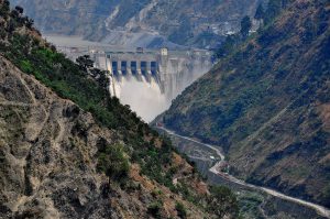
“Foremost among these threats are altered precipitation patterns and accelerated glacial melt that together trigger mass-wasting events such as landslides, as well as glacial lake outburst floods, endangering life and cultural heritage. Second, increasing variability and unpredictability in stream discharge creates challenges for hydropower generation—which threatens the foundation of Bhutan’s economic security,” says their report.
Deforestation worsens situation
Though over 70% of Bhutan’s area is under forest cover, Chencho Norbu, Secretary of the National Environment Commission, says the other important factor leading to flash floods is the loss of vegetation due to development activities. “This exposes our fragile ecosystem to more hazards,” he says, adding that any surface denuded of vegetation eases runoff during rainfall. “That’s why a lot of disasters are human-induced, mainly because of land-use change.”
Ill-prepared country
Experts have found Bhutan ill-prepared to deal with the higher frequency of disasters. In its 2015 country ranking, the Global Adaptation Institute (GAIN) index placed Bhutan at 113th out of 181 countries (with a score of 47.8). The GAIN index further shows that Bhutan ranks 134th (out of 182) in the vulnerability score (higher ranking means less vulnerable) and 91st (out of 185) in the readiness score (again, higher ranking means greater readiness to climate change). Denmark was ranked number 1, with a score of 81.3, making it the most prepared country in tackling climate change and the least vulnerable to climate change impacts.
Bhutan’s low readiness score was attributed to the country’s “low financial and investment freedom.”
Some attempts
However, there is increasing investment in the area of disaster preparedness, with support from organisations such as the Japan International Cooperation Agency, UNDP and ICIMOD.
The government is now laying emphasis on developing flood early warning systems along its rivers and building a robust national network of weather stations. Most weather stations have now been automated to provide near real-time information, and a few prediction models are being tested in selected river basins.
The National Centre for Hydrology and Meteorology has a 24/7 monitoring system in place. The Centre’s capacity has vastly improved over the years. Some of its staffs have been trained in satellite rainfall estimation methods.
“All this is expected to improve weather forecasting,” says Dupchu, adding that flash flood forecasting could still be very difficult because of several factors, not least the country’s difficult physical terrain.
Flash floods are highly localised, requiring a close network of monitoring stations. In Bhutan, these stations are few and far between. Making things more difficult, most rivers run through deep gorges and ravines, and past events show that flash floods in Bhutan happen mostly in tributaries where a small brook suddenly turns into a thundering monster sweeping huge boulders and other debris downstream.
For the 2017 monsoon, the authorities have predicted a good rainfall, mostly in the form of high-intensity short-duration showers.
“This kind of rainfall pattern is often responsible for flash floods, but we cannot say for certain if there will be flash floods this monsoon,” says Dupchu. “We will stay alert and try our best to communicate to the public whatever information we can generate.”