Climate

Death of Chorabari lake

Chorabari lake is no more, so why are the authorities building a wall to save Kedarnath from a flash flood that cannot come from that direction
<p>In 2013 the destruction caused by the overflow of the glacier lake was immense [image by: Hridayesh Joshi]</p>

In 2013 the destruction caused by the overflow of the glacier lake was immense [image by: Hridayesh Joshi]

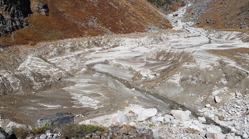
Standing almost 4,000 metres above sea level on top of the Chorabari glacier, we look down at the remains of a lake. The memories of the havoc caused by the now-dried lake are hard to erase.

On the morning of the Kedarnath flood, June 17, 2013, Chorabari lake breached its banks, bringing a massive flash flood – complete with debris and boulders – down the slope to Kedarnath. It almost wiped away the town and then roared down the Mandakini – one of the main tributaries of the Ganga – and killed thousands in Uttarakhand. Many are still missing and several bodies are still being discovered in the higher reaches of the Himalayas.

A thin thread of water trickles down the middle of the lake bed and drains out through the broken embankments. The lake where the ashes of Mahatma Gandhi were immersed – leading to its official name Gandhi Sarovar – is now a collection of mud and sand.

Cholabari lake dried up following Kedarnath flood
The Chorabari lake is almost dry now [ image by: Hridayesh Joshi]

Chorabari lake before the floods

Until it burst its banks, Chorabari was one of 14 lakes spread over the Mandakini river basin, all above 3,700 metres. At a height of 3,960 metres, Chorabari lake was almost two kilometres upstream of Kedarnath.

The lake had originally formed from meltwater at the snout of the Chorabari glacier, but due to climate change, the glacier had retreated more than 200 metres, leaving a moraine of broken debris through which little water could flow from the glacier to the lake. Since the start of the century, if not before, the lake’s water has come from snow melt and rain.

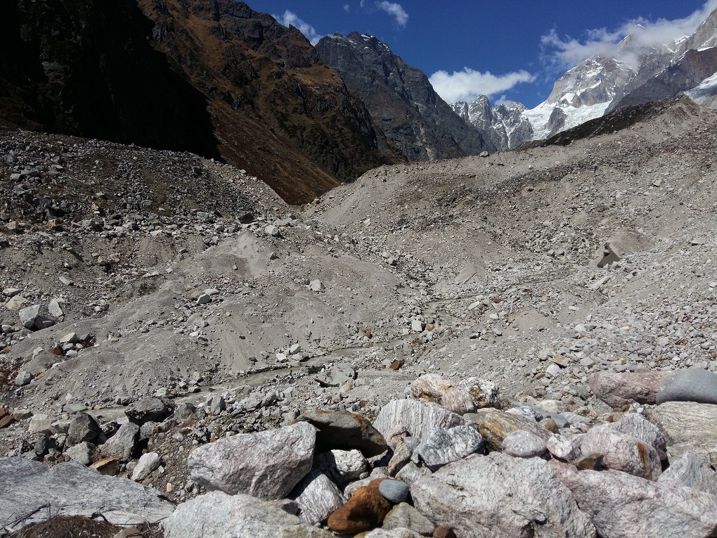
As a result, the 250 metres long and 150 metres wide lake – with a depth of 15-20 metres – had very different volumes of water at different times of the year.

Dehradun-based Wadia Institute of Himalayan Geology (WIHG) has a monitoring camp at Chorabari glacier. The scientists at the camp had found that the accumulating water was adding 2-4 metres to the depth of the lake every year. The greatest increase was of five metres in 2010, when they took measurements in October that year.

Debris left from retreating Chorabari glacier
The moraine – chewed up rocks and debris – left behind by the retreating Chorabari glacier [image by: Hridayesh Joshi]
The unstable moraine that dammed the lake was already under pressure. Then there was incessant rain and rapid snow melt in June 2013, which raised the water level by seven metres. The WIHG monitoring camp recorded 315 mm of rain in just 24 hours.

Unusual at that altitude, such heavy rainfall attributes to climate change by scientists at the Intergovernmental Panel on Climate Change.

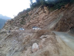
The result was a disaster not just in Kedarnath, but all the way downstream at Rambara, Gaurikund, Sonprayag and Agastyamuni.

What happened to Chorabari lake?

D.P. Dobhal, a glaciologist at WIHG, has been studying the Chorabari glacier and lake for several decades.  explained why Chorabari lake burst its banks. “A huge avalanche came down in the lake on the morning of June 17 and created immense pressure on the embankments. The lake had already much more water than usual and continuous rain had weakened its embankments. The sudden increase of pressure broke the moraine embankment and the lake emptied in a few minutes, taking a large amount of debris and huge boulders along with water.”

In a detailed report prepared after the disaster, WIHG said, “The bursting of this lake led to its complete drainage in 5 to 10 minutes.” Given the size of the lake, that meant over 262 million litres of water roared down the Mandakini within those ten minutes.

Useless Kedarnath wall

Wall built around Kedarnath town
A wall is being built to protect the town, but there is no water in the lake to create danger [image by: Hridayesh Joshi]
With the embankments broken by the flash flood, there is no possibility of the lake filling with water again, Dobhal points out, “for at least the next 100 years, until any deposit once again plugs the broken embankment. This looks very unlikely.”

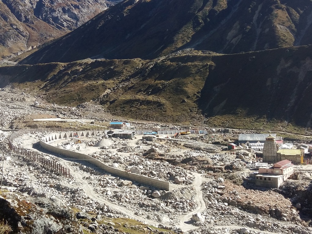
Despite what scientists say, a huge multi-layered wall is being built downstream to protect the pilgrimage spot from another flash flood. “The main purpose of this wall around Kedarnath town is to save it from future threats of floods and landslides,” says a worker at the spot, a threat that is unlikely to come in a century.

Also see: Climate change, poor policies multiply Himalayan flood effects

Cookies Settings

Dialogue Earth uses cookies to provide you with the best user experience possible. Cookie information is stored in your browser. It allows us to recognise you when you return to Dialogue Earth and helps us to understand which sections of the website you find useful.

Required Cookies

Required Cookies should be enabled at all times so that we can save your preferences for cookie settings.

Dialogue Earth - Dialogue Earth is an independent organisation dedicated to promoting a common understanding of the world's urgent environmental challenges. Read our privacy policy.

Cloudflare - Cloudflare is a service used for the purposes of increasing the security and performance of web sites and services. Read Cloudflare's privacy policy and terms of service.

Functional Cookies

Dialogue Earth uses several functional cookies to collect anonymous information such as the number of site visitors and the most popular pages. Keeping these cookies enabled helps us to improve our website.

Google Analytics - The Google Analytics cookies are used to gather anonymous information about how you use our websites. We use this information to improve our sites and report on the reach of our content. Read Google's privacy policy and terms of service.

Advertising Cookies

This website uses the following additional cookies:

Google Inc. - Google operates Google Ads, Display & Video 360, and Google Ad Manager. These services allow advertisers to plan, execute and analyze marketing programs with greater ease and efficiency, while enabling publishers to maximize their returns from online advertising. Note that you may see cookies placed by Google for advertising, including the opt out cookie, under the Google.com or DoubleClick.net domains.

Twitter - Twitter is a real-time information network that connects you to the latest stories, ideas, opinions and news about what you find interesting. Simply find the accounts you find compelling and follow the conversations.

Facebook Inc. - Facebook is an online social networking service. China Dialogue aims to help guide our readers to content that they are interested in, so they can continue to read more of what they enjoy. If you are a social media user, then we are able to do this through a pixel provided by Facebook, which allows Facebook to place cookies on your web browser. For example, when a Facebook user returns to Facebook from our site, Facebook can identify them as part of a group of China Dialogue readers, and deliver them marketing messages from us, i.e. more of our content on biodiversity. Data that can be obtained through this is limited to the URL of the pages that have been visited and the limited information a browser might pass on, such as its IP address. In addition to the cookie controls that we mentioned above, if you are a Facebook user you can opt out by following this link.

Linkedin - LinkedIn is a business- and employment-oriented social networking service that operates via websites and mobile apps.