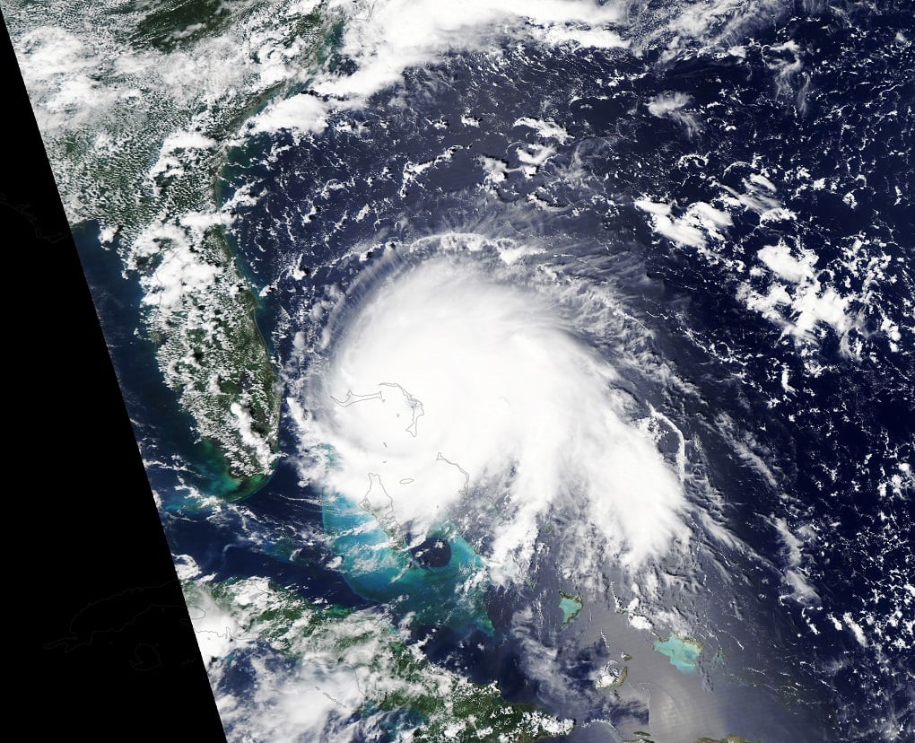
In the first week of September 2019, Hurricane Dorian left a path of destruction from the Caribbean to the Canadian Maritimes. Reaching category 5 strength for nearly two days and sustaining major hurricane status from August 30 to September 3, the storm devastated the northern Bahama Islands, strafed the southeast U.S. coast, and arrived in Nova Scotia as one of the five strongest hurricanes on record for that region.
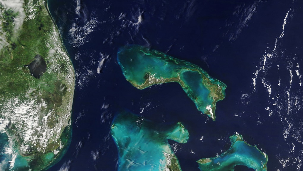
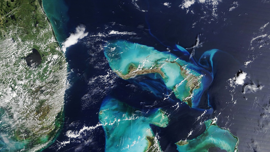
The images above provide a broad view of the devastation in the northern Bahamas, which were lashed for nearly 40 hours by the second strongest Atlantic hurricane in modern meteorological records. The Moderate Resolution Imaging Spectroradiometer (MODIS) on NASA’s Terra satellite acquired these natural-color images of Great Abaco Island and Grand Bahama on August 17 and September 7, 2019. Note the change in the color of the island landscape from green to brown, as well as the brightening of the reefs and shoals around the island due to sediments stirred up by the storm.
The widespread browning of Great Abaco and Grand Bahama could have several causes. Many trees were uprooted and destroyed by the storm, and some species of vegetation in the tropics have evolved to lose leaves and small branches in strong winds. The loss of leafy vegetation would give the satellite a view of more bare ground. Another possibility is that salt spray whipped up by the hurricane coated and desiccated some leaves while they were still on the trees.
Government officials from the Bahamas have reported at least 40 deaths, according to news accounts, though the number is expected to rise after search and rescue operations are complete. Hundreds of people are missing and an estimated 70,000 are homeless. Few areas have electric power or running water. National and international relief supplies are just beginning to arrive in the area, though transportation is difficult.
At the other end of the storm track, Dorian brought destructive winds and waves 1500 miles (2400 kilometers) to the north. After transitioning to an extra-tropical cyclone, the storm made landfall in Nova Scotia on the evening of September 7 at category 2 strength. Maximum wind speeds approached 100 miles (160 kilometers) per hour at the coast. According to Weather Underground, hurricane-force winds extended 115 miles (185 kilometers) from the center of the storm, and tropical storm-force winds extended 300 miles (500 kilometers).
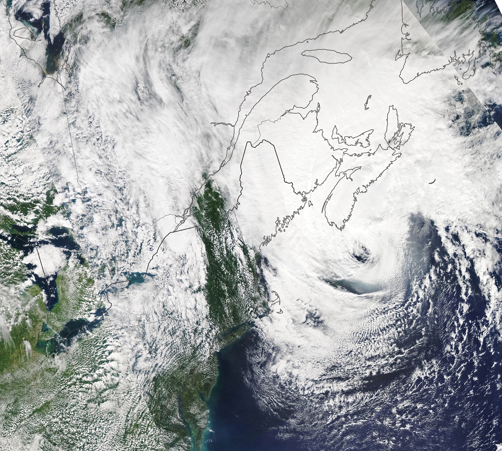
The Moderate Resolution Imaging Spectroradiometer (MODIS) on NASA’s Aqua satellite captured this natural-color image of the vast storm just after midday on September 7, 2019.
According to news reports, Dorian knocked out power to more than 500,000 customers in the Canadian Maritime Provinces, including Nova Scotia. A near-record storm surge was observed in the harbor at Halifax and along the coast of New Brunswick. And according to preliminary weather data, an offshore weather buoy measured a peak wave height of 30.7 meters (100.7 feet) in the open ocean.
NASA Earth Observatory images by Lauren Dauphin, using MODIS data from NASA EOSDIS/LANCE and GIBS/Worldview. This story has been republished with permission



![Young girls at a dug well in a remote village near Thano Bula Khan in Jamshoro Dirsticrt near Karachi. Kohistan is an arid region and suffering with severe droughts for many years [image by: Zulfiqar Kunbhar]](https://dialogue.earth/content/uploads/2018/03/Pic-01-300x200.jpg)
