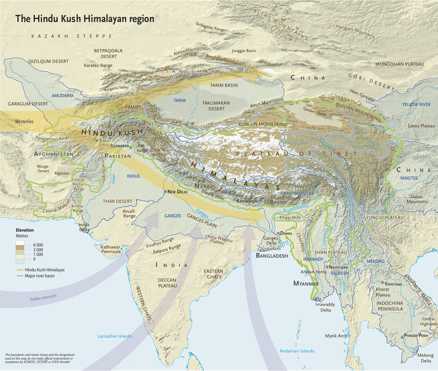
The new atlas, released today at the UN climate summit, is based on years of data from five of the ten main river basins in the Himalayas: the Brahmaputra, Ganges, Indus, Mekong and Salween. It uses maps and infographics to show how the region’s climate is changing now and into the future, with severe consequences for populations, both local and downstream.
“Mountains are beautiful but we shouldn’t forget that they are the most fragile landmass on earth and need more care,” said David Molden, director general of the Kathmandu based International Center for Integrated Mountain Development (ICIMOD).
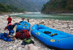
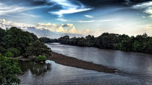
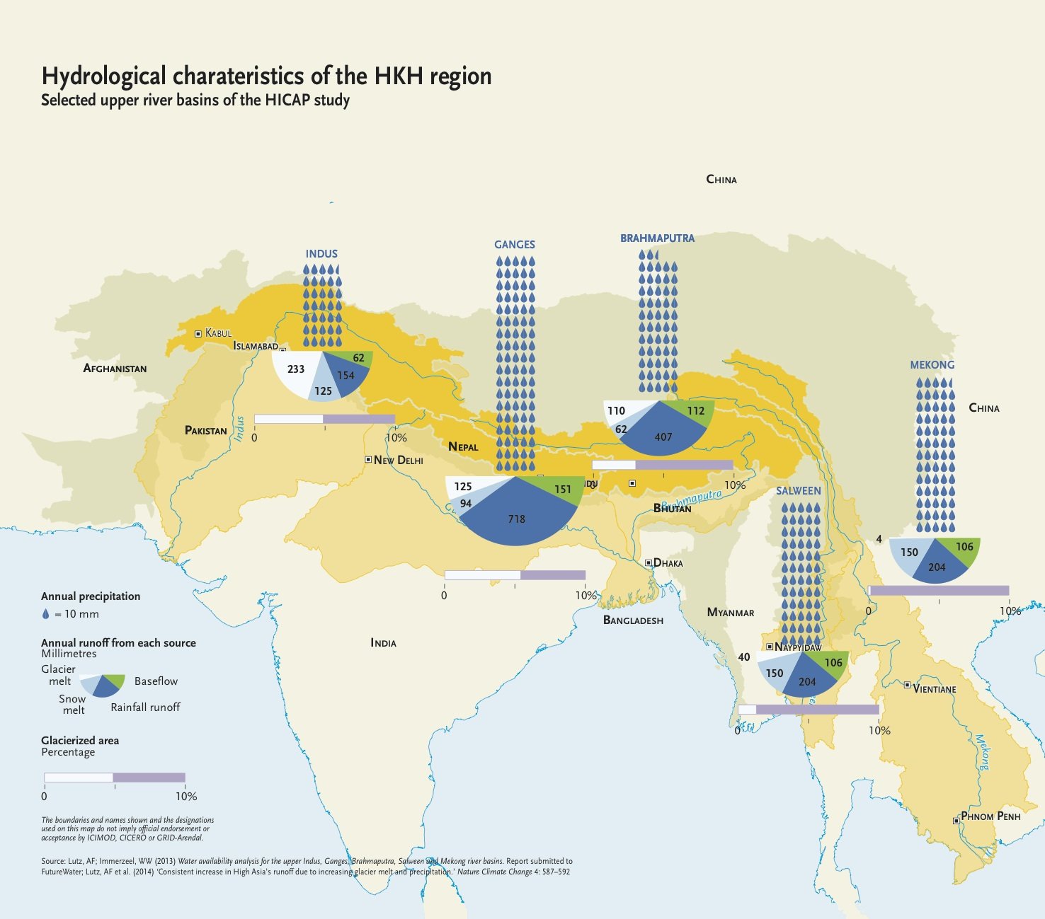
The Hindu Kush Himalayas are known as the water tower of Asia. Snow, glaciers and rainfall from the mountains feed the ten largest river systems in Asia. Together these rivers support the drinking water, irrigation, energy, industry and sanitation needs of 1.3 billion people living in the mountains and downstream.
“This atlas is an initiative to simplify complex scientific information generated for decades and allows policymakers to understand the real picture of threats due to climate change,” said Björn Alfthan, project manager of the Polar and Cryosphere Division at GRID-Arendal, Norway.
“Mountains are beautiful but we shouldn’t forget that they are the most fragile landmass on earth and need more care,” said David Molden, director general of the Kathmandu based International Center for Integrated Mountain Development (ICIMOD).
The Hindu Kush Himalayas are known as the water tower of Asia. Snow, glaciers and rainfall from the mountains feed the ten largest river systems in Asia. Together these rivers support the drinking water, irrigation, energy, industry and sanitation needs of 1.3 billion people living in the mountains and downstream.
“This atlas is an initiative to simplify complex scientific information generated for decades and allows policymakers to understand the real picture of threats due to climate change,” said Björn Alfthan, project manager of the Polar and Cryosphere Division at GRID-Arendal, Norway.
Data gaps
The Intergovernmental Panel on Climate Change’s fourth assessment report called the region a “white spot” because of the lack of information and experts say the situation has not improved much. “Data gaps in the Hindu Kush Himalayas are still very large and most of the analyses are based on modelled data. Countries should come together to share data and undertake more rigorous,” added Molden.
The atlas recommends the United Nations Framework Convention on Climate Change should initiate a comprehensive assessment of the Himalayan glaciers and river flow to fill the remaining gaps.
“Although the total amount of water flowing within some of Asia’s biggest rivers such as the Ganges, Brahmaputra and Indus is not expected to decrease until 2050, we can expect higher variability and more floods and droughts,” the report concluded.
The report was jointly produced by International Centre for Integrated Mountain Development (ICIMOD), GRID-Arendal and the Centre for International Climate and Environmental Research-Oslo (CICERO).
Major findings:
- Temperatures across the mountainous Hindu Kush Himalayan region will increase by about 1–2°C (in some places by up to 4–5°C) by 2050.
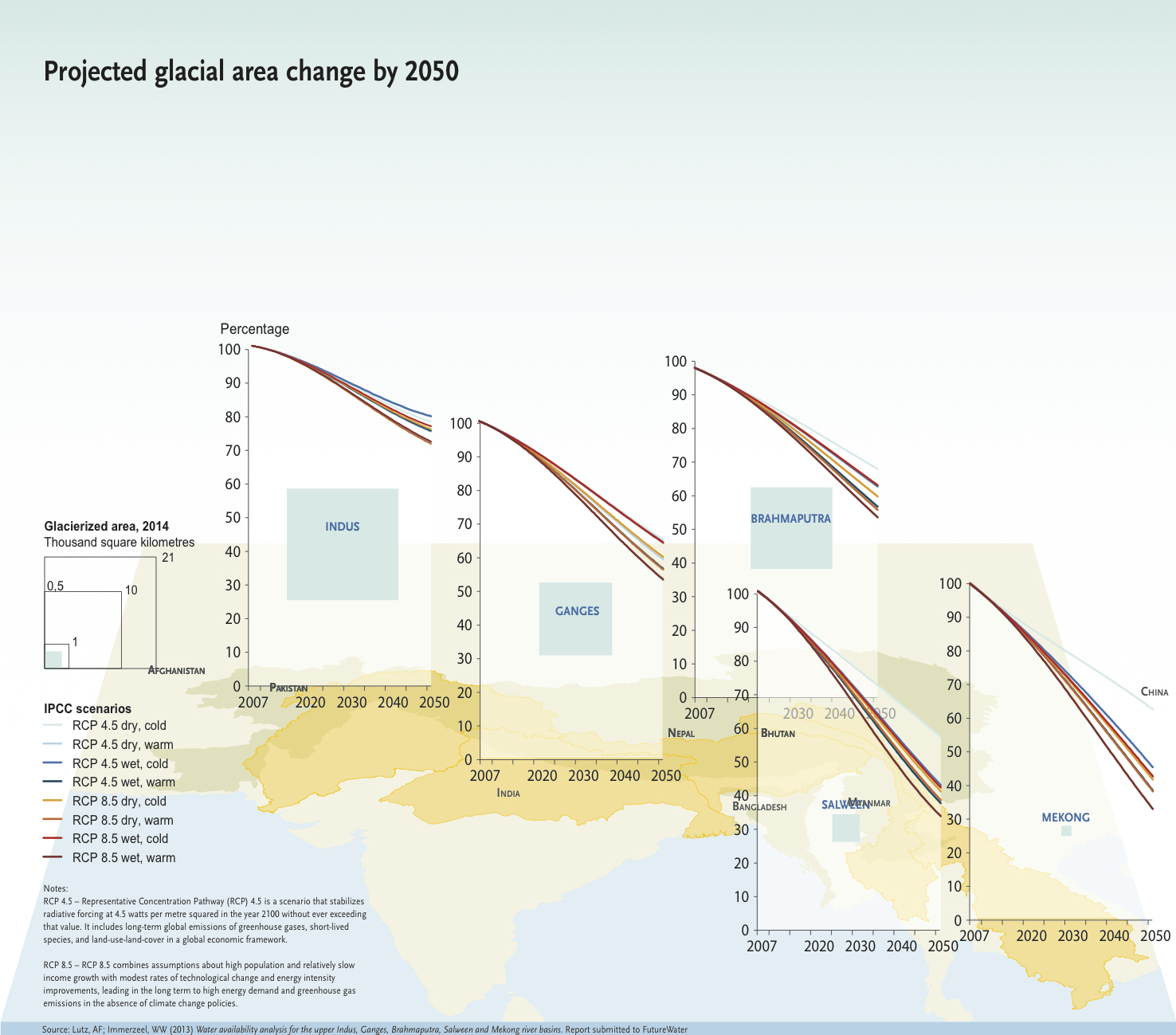
- Glaciers will continue to suffer substantial ice loss, with the main loss in the Indus basin.
- Precipitation will change with the monsoon expected to become longer and more erratic.
- Extreme rainfall events are becoming less frequent, but more violent and are likely to increase in intensity.
- Communities living immediately downstream from glaciers are the most vulnerable to glacial changes.
- Despite overall greater river flow projected, higher variability in river flows and more water in pre-monsoon months are expected, which will lead to a higher incidence of unexpected floods and droughts, greatly impacting on the livelihood security and agriculture of river-dependent people.
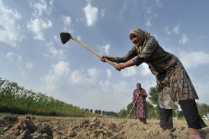
- Changes in temperature and precipitation will have serious and far-reaching consequences for climate-dependent sectors, such as agriculture, water resources and health.

Read the full report here.