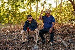
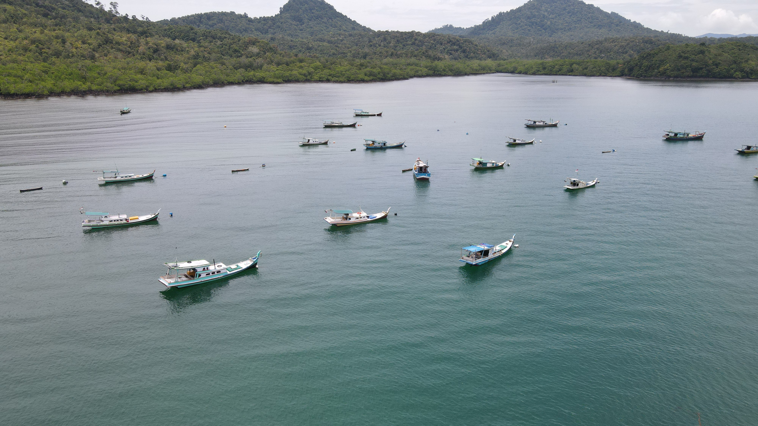
![<p data-guid="a864dd5a-8e00-468c-8b9a-50ea2ff9f518" data-pm-slice="1 1 []">Fishing communities in Indonesia depend on animals that can originate as larvae over 100 km away. Protecting the highways that connect different ocean sites is vital (Image © Yayasan Planet Indonesia)</p>](https://dialogue.earth/content/uploads/2026/05/Karimata-coastline_RoniPlane-tIndonesia-2400x1350.jpg)

Indonesia’s fisheries are vast, worth billions of dollars and sustaining millions of people.
They are also under threat from overfishing, bottom trawling, destructive fishing practices, mangrove conversion, and a changing climate.
Local governance matters in combatting these issues. We see this in the recovery of reefs and the return of life to coastal areas managed by local people in West Kalimantan where my organisation works. These fish and crustaceans spill over into adjacent waters, benefiting even more fishers.
But helping a single community manage a stretch of coast can feel like placing a single sandbag against a rising tide. Currents don’t stop at village boundaries, animals don’t know where one well managed area ends and another begins.
For a long time, we didn’t have the data to connect what was happening at each site into something that told a regional story.
Now we do.
Larvae don’t read maps, but we can
We recently analysed how larvae move across the West Kalimantan seascape, modelling 25 years of ocean circulation and simulating the dispersal of larvae for several commercially important animals, including mud crabs, silver pomfret, groupers, snappers, and banana and tiger shrimp.
The modelling maps where larvae are produced, where they settle, and how they move between sites on ocean currents. Some coastal areas are net exporters of larvae (sources). Others are net receivers, or sinks, where larvae settle and recruit into adult populations. A few rare locations are both and we call these “unicorn sites”, ecological engines that stabilise fisheries across entire networks. You can explore our full methodology and results here.
The analysis confirmed what we’d long suspected but never had the data to prove: the connectivity across this seascape is enormous. Nearly 12 million hectares of ocean along the West Kalimantan coast, stretching away from Borneo toward South Sumatra, function as a single interconnected system of larval highways.
Mud crabs reproducing in the Karimata archipelago are connected to mangroves over 100 km down the coast. Grouper and snapper breeding in Karimata supply reefs around the islands of Bangka and Belitung, over 250 km to the south. These aren’t pelagic species crossing open ocean. They’re fish that move between coral reefs and coastal habitats including mangroves, seagrass beds and estuaries. Yet their larvae are traveling distances that span multiple districts, jurisdictions and governance systems.
If animals depend on connectivity at this scale, management has to operate at this scale too. Banning fishing at one key site may fuel recovery across the whole network. But a stretch of unmanaged coastline between two community-managed areas can break the chain. Larvae need intact spawning grounds and nursery habitats to complete their journey. Bottom trawling, dynamite fishing, and mangrove conversion strip away the very habitats that hold the network together.
A few pennies for millions of hectares
The connectivity analysis didn’t just show us the problem. It showed us exactly what the solution looks like, and how far we are from funding it.
Today, Planet Indonesia works alongside more than 10,000 coastal fishers in West Kalimantan, supporting governance over half a million hectares of locally managed marine areas and government-recognised marine protected areas. But we can’t restore fisheries across this system with a handful of isolated MPAs.
What we need is a network of locally managed marine areas (LMMAs), government-designated MPAs, offshore regulations, and community-led no-take zones (a subset of LMMAs), all connected and governed across the full seascape.
We have a proof of concept. Our connectivity work directly informed the rezoning of over 380,000 hectares of marine coastline and small islands in 2026, shaping the livelihoods of more than 15,000 fishers directly and likely three times that indirectly.
Community governance bodies used the ecological evidence to advocate for formal rezoning with government. The science gave them the data. Their institutions made it stick.
But 380,000 hectares is a fraction of the 12 million hectare system we now know exists. We can see what the next decade of work looks like and we need an army of communities with the right supporters behind them.
The question is whether anyone is willing to fund it.
The network nobody wants to pay for
Most conservation donors are not built for such a huge undertaking.
Some are genuinely interested but not structured for it. Their grant cycles are too short, their reporting frameworks reward projects rather than systems, and they want a clear beginning, middle and end.
Some donors are simply unwilling because the timeline is too long, the geography too complex, the outcomes too distributed across communities and institutions to fit into a single reportable metric. Others would rather fund one top-down regional fisheries plan or government MPA designation than a network of regional groups.
There’s a persistent attitude in parts of the conservation sector that treats community-led marine management as a feel-good add-on
Fifty community governance bodies managing their own marine areas, making their own decisions, negotiating their own boundaries with government – that’s messy. It’s also the only thing we know of that actually works.
The frustrating part is that the science now shows us exactly what the solution looks like. This makes the gap between what we know and what we can support impossible to ignore.
Locally led is more than a nice-to-have
There’s a persistent attitude in parts of the conservation sector that treats community-led marine management as a feel-good add-on – something you fund at the margins once the “real” conservation work is done. First its policy frameworks, enforcement budgets, large-scale designations. Then community governance if there’s money left over.
Our connectivity analysis makes that hierarchy indefensible. Grouper larvae travelling 180 km from Karimata to Belitung don’t care about a single protected area and a policy document. We need functioning governance at multiple points along that highway.
And yet locally led management continues to be funded like a pilot project.
Ocean protection is already hugely underfunded. Only USD 1.2 billion per year flows to ocean protection globally, against an estimated need of USD 15.8 billion, found the Ocean Protection Gap Report, 2025. And the money that does flow is focused on climate change and carbon, to the neglect of the food systems that millions of coastal families depend on.
The math isn’t the problem. Community-led marine management is one of the highest-return investments in conservation we know of: Planet Indonesia’s internal data puts our cost as low as USD 2.50 per hectare across our terrestrial work, and around USD 1.75 per hectare in coastal waters. To set that against the scale of the task, Indonesia’s coastline alone is long enough to wrap around the African continent three and a half times. The architecture of conservation finance, not the cost of community-led conservation, is what’s missing.
The result is predictable: a few pennies to address a problem that spans millions of hectares. Only 2.7% of the ocean is effectively managed today with active governance ensuring minimal damaging activities. The rest of the roughly 10% of the ocean that is nominally protected is paper parks: lines on a map with no institutions behind them.
Aliansi Bumi Kita – Our Earth Alliance – is an example of what the alternative looks like. Seven grassroots organisations across Indonesia, each rooted in their own landscapes and communities, working together to secure community tenure over marine and terrestrial resources, strengthen governance systems, and build evidence across sites. Not one organisation scaling up but a network of local actors connecting their place-based work into something larger, something that starts to match the scale of the problem.
That means funding communities across multiple landscapes, investing in the coordination and data systems, and strengthening institutions to let community-led management grow without losing what makes it work. It means trusting that the people who fish these waters and govern these coastlines know what they need to do – and resourcing them to do it.
The connectivity maps have given us something rare in conservation: a clear picture of what regional recovery actually requires. The biology says the solution is networked. The funding needs to be too.